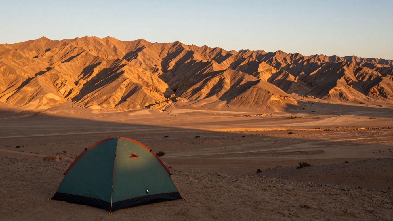
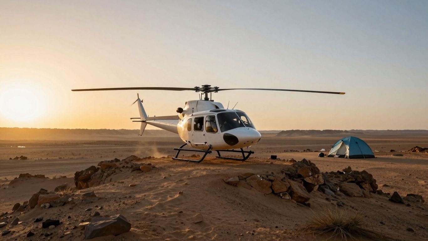
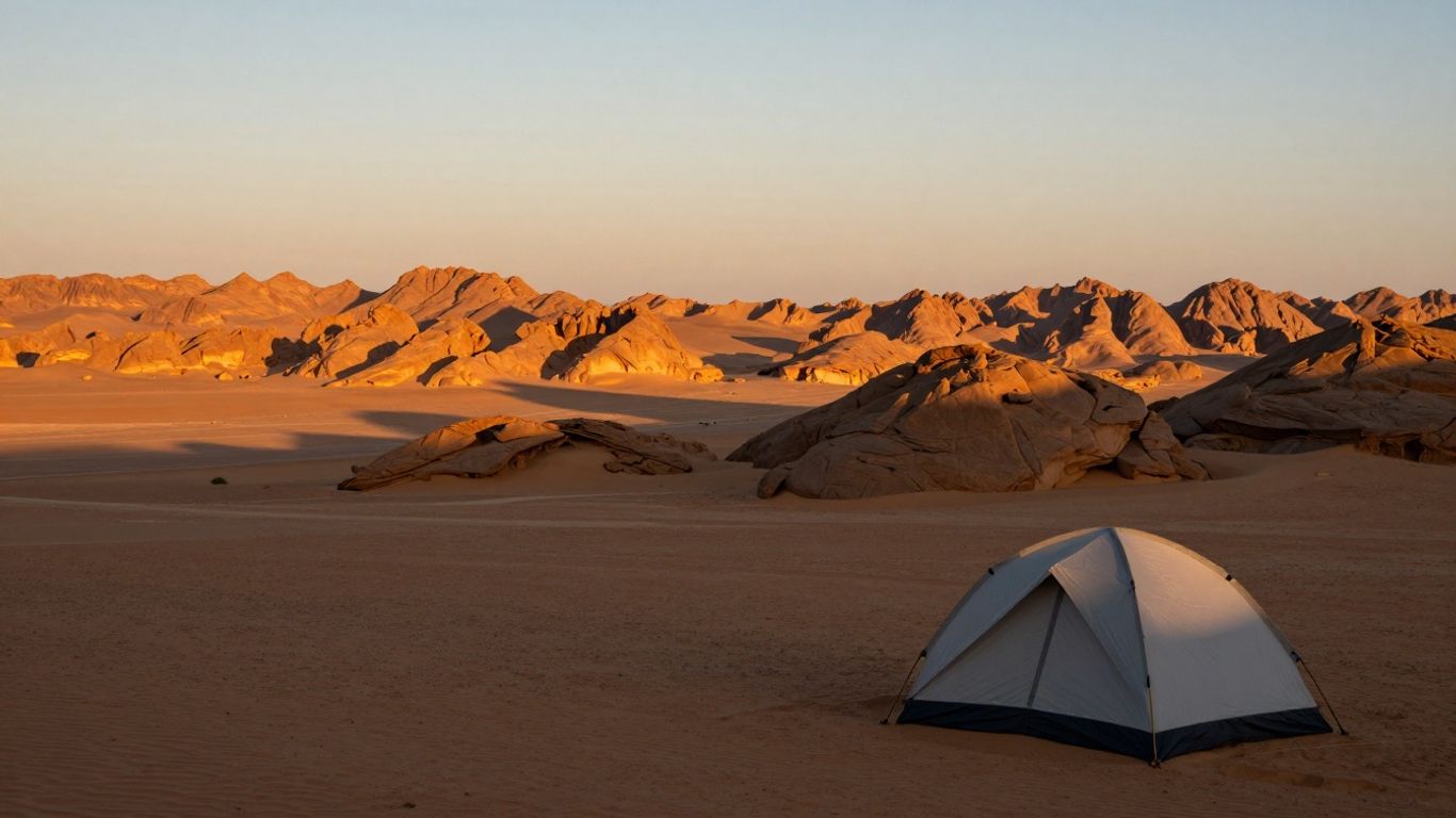
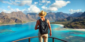
Thinking about a trip that mixes epic views with a bit of adventure? Desert heli-hikes are becoming a thing, and honestly, they sound pretty amazing. Imagine soaring over vast canyons and landing somewhere remote to explore on foot, all before heading back to a cool, comfy spot. It’s a way to see places you just can’t get to easily, and it beats the usual tourist crowds. We’re talking about amazing sunrises from ridges and relaxing in nice tents or suites afterward. It’s a pretty sweet deal for anyone looking for something a little different.
Key Takeaways
Desert heli-hikes offer a unique way to access remote hiking spots, especially for sunrise views from high ridges.
Locations like Amangiri and Dunton Hot Springs provide luxury accommodations, blending adventure with comfort.
Trails such as South Kaibab and Bright Angel in the Grand Canyon offer various challenges, from day hikes to multi-day treks.
Consider the season carefully; summer heat is dangerous, while spring and fall offer more pleasant hiking conditions.
Proper planning is essential, including water, safety precautions, and understanding trail difficulty and water availability.
Amangiri Suites
Tucked away in the dramatic red rock country of southern Utah, Amangiri feels like a secret whispered by the desert itself. It’s not just a place to stay; it’s an experience designed to immerse you in the stark beauty of the landscape. The suites and glamping tents here are built to blend right into the mesas and canyons, making you feel like you’re part of the scenery.
When you’re not out exploring, you can cool off in your own private plunge pool or enjoy meals inspired by the Southwest. For the adventurous, there are private hiking trails, yoga sessions out in the open, and guided tours through slot canyons. It’s a place where luxury meets the wild, offering a unique way to connect with the desert.
Here are some of the activities you might find:
Hiking on exclusive trails
Guided stargazing sessions
Private via ferrata adventures
Exploring slot canyons with local guides
Amangiri offers a serene escape, allowing guests to truly appreciate the vastness and quiet of the desert environment. It’s a chance to disconnect from the everyday and reconnect with nature in a truly special setting.
Dunton Hot Springs
Imagine stepping back in time, but with all the modern comforts. That’s Dunton Hot Springs for you. Nestled in the Colorado Rockies, this place is pretty unique. It’s basically a collection of historic log cabins, a saloon that looks like it’s straight out of an old Western, and, of course, those famous hot springs.
It feels like your own private ghost town, but with a serious upgrade. You can soak in the mineral-rich waters, which are housed in a really cool, rustic wooden building. The vibe here is a blend of rugged backcountry and a touch of luxury. They even have a library where you can borrow books, which is a nice touch after a day of exploring.
What to do around Dunton:
Soak in the natural hot springs.
Explore the historic cabins and saloon.
Go horseback riding or fly fishing.
Enjoy the stunning mountain scenery.
It’s a place that really lets you disconnect and enjoy the quiet beauty of the mountains. If you’re looking for a getaway that’s a bit different, Dunton Hot Springs is definitely worth considering.
South Kaibab Trail
The South Kaibab Trail is a direct route down the Grand Canyon’s South Rim, known for its steep descent and wide-open views. It’s about 7 miles long, dropping around 4,780 feet to the Colorado River. Unlike some other trails, South Kaibab follows the ridgeline, which means you get incredible, unobstructed panoramas for most of the hike. But, and this is a big ‘but,’ there’s absolutely no shade and no water along the entire trail. You have to carry everything you need from the rim.
This trail is definitely a leg-burner. It’s designed for a quick, steep descent, so don’t expect gentle switchbacks. The lack of shade makes it particularly challenging, especially during warmer months. The National Park Service strongly advises against hiking to the river and back in a single day, particularly from May through September. It’s a strenuous hike, and the climb back up can take twice as long as the way down.
Here are a few key points to consider:
No Water: You must carry all the water you’ll need. There are no sources along the trail.
No Shade: Be prepared for full sun exposure for the entire hike.
Steep Descent: The trail drops quickly, offering dramatic views but demanding physical effort.
Ridgeline Route: You’ll be hiking along the top of the canyon’s spine for much of the way.
Because of the conditions, most people use the upper sections for day hikes to viewpoints. Places like Ooh Aah Point (about 0.9 miles down) or Cedar Ridge (about 1.5 miles down) offer fantastic scenery without requiring a full descent. These spots are great for a taste of the canyon’s grandeur without the extreme commitment.
The South Kaibab Trail offers a unique perspective of the canyon’s vastness due to its ridgeline path. While the views are spectacular, the complete absence of water and shade makes it a demanding choice. Hikers should be exceptionally well-prepared, carrying ample water and sun protection, and understanding that the return journey is significantly more taxing than the descent.
Bright Angel Trail
The Bright Angel Trail is a well-trodden path on the South Rim, offering a more accessible route into the canyon compared to some of its wilder counterparts. It’s a popular choice because it provides a good balance of challenge and comfort, making it suitable for a range of hikers.
This trail descends from Grand Canyon Village, following a natural fault line that offers some protection from the sun, especially in the upper sections. You’ll find yourself winding through switchbacks that reveal layers of geological history, a truly impressive sight. It’s important to remember that hiking down is only half the battle; the climb back up will take significantly more effort and time.
Here are some key points about hiking the Bright Angel Trail:
Water Availability: You’ll find year-round water at Havasupai Gardens (mile 4.6). Seasonal water is typically available from May to September at the 1.5-Mile and 3-Mile Resthouses. Always check the current water status at the Visitor Center before you go, as the water lines can sometimes have issues.
Rest Stops: The trail is dotted with resthouses at the 1.5-mile and 3-mile marks. These spots offer shade and restrooms, making them great turnaround points for day hikers.
Havasupai Gardens: This oasis at mile 4.6 is a significant waypoint, offering shade, water, and a ranger station. It’s a popular destination for those looking for a longer day hike or an overnight stop.
While the full trail goes all the way to the Colorado River, many people enjoy hiking just a portion of it. Turning around at the 1.5-Mile Resthouse makes for a manageable 3-mile round trip, while heading to the 3-Mile Resthouse is a 6-mile round trip. These shorter options still give you a real sense of descending into the canyon without requiring an overnight stay.
Hiking down into the Grand Canyon is deceptively easy. The real challenge comes when you have to climb back out. Always plan for the return trip to take twice as long and be much more strenuous than the descent. Carry plenty of water and know your limits.
North Kaibab Trail
The North Kaibab Trail is the Grand Canyon’s sole maintained corridor trail originating from the North Rim, and it’s a serious undertaking. This path stretches 14 miles down to the Colorado River, meaning a 5,850-foot drop in elevation from the rim’s 8,241 feet. It’s the only trail on the North Rim that connects you to the inner canyon, and it’s known for taking hikers through a remarkable range of ecosystems, from the cool forests near the top to the desert environment at the bottom.
Unlike the trails on the South Rim, the North Kaibab follows Bright Angel Creek for a good portion of its length. This means you’ll have a consistent water source nearby and will pass through a greener, more lush area that supports a lot of wildlife. It’s a different kind of Grand Canyon experience.
This trail is best suited for experienced hikers or those planning an overnight trip. Day hiking to the river and back is strongly discouraged by the National Park Service due to the extreme difficulty and time commitment.
Here are some key points along the trail:
Coconino Overlook: About 0.75 miles down, offering the first real dramatic view.
Supai Tunnel: At 1.7 miles, this is a good turnaround point for a shorter hike. There’s seasonal water here from May to October and restrooms.
Roaring Springs: Located 4.7 miles from the rim, this is a spectacular waterfall and a popular destination for day hikers. It’s also the source of much of the park’s treated water.
Cottonwood Campground: At 6.8 miles, this is a designated camping area for those making it a multi-day trip.
Bright Angel Campground: The end of the line at 14 miles, right by the Colorado River. Camping here requires a permit.
Water is available seasonally at Supai Tunnel and year-round at Cottonwood and Bright Angel Campgrounds, but it’s always wise to check the current status before you go. The North Rim itself is only accessible from mid-May to mid-October, and even then, the upper parts of the trail can be icy in early spring and late fall.
Hiking the North Kaibab Trail is a significant challenge that requires careful planning and preparation. The descent is demanding, but the return climb is even more so. It’s vital to understand your limits and the trail’s conditions before setting out.
Hermit Trail
The Hermit Trail is a historic route that offers a more rugged and less-trafficked experience into the Grand Canyon compared to the main corridor trails. Built in the early 1900s to serve a now-gone luxury camp, it descends from Hermits Rest on the West Rim. This trail is not for casual day hikers; it’s a challenging path that demands preparation and respect.
This trail is considered a "threshold" route, meaning it receives minimal maintenance. Expect steep, rocky sections, significant erosion, and loose scree, especially in the upper portions. The first 2.5 miles are particularly demanding, with a steep drop through switchbacks. While some restoration occurred in 1997, large parts remain in a natural, unmaintained state. This means you’ll need to be comfortable with route-finding and careful footing.
Key points to consider for the Hermit Trail:
Water Sources: Water is scarce and unreliable. Santa Maria Spring, about 2.5 miles down, offers a seasonal trickle that must be treated. Dripping Springs, accessed via a side trail, is also seasonal. Hermit Creek, around 7.8 miles, may have water depending on the season. Always carry more water than you think you’ll need and have a reliable filtration or purification method.
Hiking Time: Due to the trail’s condition, progress is much slower than on maintained trails. Plan for significantly longer hiking times. A descent can take 6-8 hours, while the ascent might require 8-10 hours. Many hikers opt for a strenuous overnight trip.
Permits & Gear: Day hiking doesn’t require a permit, but overnight camping in the designated Hermit use areas (BM7/BM8) does, and these permits are limited. The National Park Service strongly recommends sturdy hiking boots, not trail runners, because of the rough, rocky terrain.
The Hermit Trail connects to the Tonto Trail, allowing for longer, more adventurous loop hikes, often combined with the Bright Angel Trail for a return trip. For those seeking solitude and a genuine backcountry feel, this historic path provides a stark contrast to the busy main trails. It’s a route that rewards experienced hikers with stunning, remote canyon vistas and a true sense of accomplishment.
Grandview Trail
The Grandview Trail isn’t for the faint of heart, or really, for anyone who isn’t already a seasoned desert hiker. This path plunges down from Grandview Point, and it does so with a steepness that’ll make you question your life choices. It’s a historic route, originally built back in 1893 to get to copper mines on Horseshoe Mesa, so it’s got some serious history, but it also means it’s pretty rough.
This trail is significantly steeper and more challenging than the more popular corridor trails like Bright Angel or South Kaibab. You’ll find yourself dealing with loose rocks and some seriously dizzying switchbacks. If you’re not comfortable with heights or have shaky footing, this might not be the best choice for you. It’s a real workout, both going down and, especially, coming back up.
Here’s a quick rundown of what to expect:
Destination: Horseshoe Mesa (6.4 miles round trip)
Key Waypoint: Coconino Saddle (2.2 miles round trip) offers a brief break.
Water: Absolutely none on the trail. You need to carry all the water you’ll need for the entire trip – think at least 3-4 liters per person, more if it’s warm.
Time: Plan for at least 4-6 hours for the round trip to Horseshoe Mesa, and that’s for experienced hikers moving at a good pace. The terrain really slows you down.
Remember, sturdy hiking boots are a must here. Trail runners just won’t cut it for the ankle support you’ll need on this rocky, steep ground. It’s a demanding hike, but the views and the sense of accomplishment are pretty incredible if you’re prepared.
Thunder River Trail
The Thunder River Trail is not for the faint of heart, or really, for anyone who isn’t an experienced desert hiker. This route is seriously remote and has seen a couple of hiker fatalities in recent years, so it’s definitely an expert-level trek. It starts from the North Rim, usually accessed via the Bill Hall Trail, and winds its way down into the canyon.
What makes it special? Well, it leads you to Thunder River, which is pretty wild because it’s one of the shortest rivers in the world. It pops right out of some caves and flows for about half a mile before joining up with Tapeats Creek. This area is known for being a lush, green oasis in the middle of the harsh desert, thanks to these reliable water sources that have been drawing people for ages. You’ll find water at Thunder River, Tapeats Spring, and Deer Spring, but remember to treat all water you collect.
This is typically a multi-day trip, often taking 3 to 5 days, especially if you plan to extend your hike to see Deer Creek Falls. The exact mileage can change depending on how you get there and what your final destination is. Serious planning, top-notch physical condition, and experience with exposed and tricky terrain are absolute musts for this trail.
Because it’s so out of the way and the terrain can be tough, rescue access is limited. If you’re considering this hike, you should be an expert canyon hiker, ideally with some wilderness medicine knowledge and a way to communicate via satellite. You’ll also need a backcountry permit for the specific camping areas you plan to use.
Safety is the number one concern here. It’s a challenging route that demands respect and thorough preparation.
Cape Royal Trail
The Cape Royal Trail on the North Rim is a fantastic option if you’re looking for big views without a big effort. It’s a short, mostly paved path, making it super accessible for pretty much everyone. You’ll wander through some nice ponderosa pines for a bit, and then bam – you’re at an overlook that just drops away on three sides. It’s pretty wild.
From here, you get these incredible, sweeping vistas. You can see down into Bright Angel Canyon, and if you look east, you’ll catch sight of the Desert View Watchtower way off in the distance. The sunrise from Cape Royal is something else; the way the light hits the canyon walls is just stunning. It’s a quick hike, usually taking about 30 minutes round trip, but honestly, you’ll probably want to linger longer to soak it all in. It’s a great spot to just stand and stare.
Here’s a quick rundown:
Distance: About 0.8 miles round trip.
Difficulty: Easy, mostly paved.
Time: Plan for 30 minutes, but allow more for photos.
Best for: Sunrise, panoramic views, families, and those seeking an easy but impactful experience.
Remember to check the park’s current conditions before you go. Sometimes trails have temporary closures for maintenance or other reasons. While this trail is generally easy, the sheer scale of the canyon can be awe-inspiring, so take your time and enjoy the scenery.
Point Imperial
Standing at 8,800 feet, Point Imperial holds the title of the highest overlook on the Grand Canyon’s North Rim. It’s a spot that truly lives up to its name, offering a commanding perspective that stretches far beyond the immediate canyon walls. On a clear day, your gaze can travel all the way to the Painted Desert and Marble Canyon, with the ancient rock layers laid out like a geological timeline.
This vantage point is particularly special at sunrise. As the first light spills over the horizon, it paints the distant buttes and mesas in a spectrum of warm colors, creating a panorama that begs for more than a fleeting glance. It’s a scene that feels both vast and intimate, a quiet moment to appreciate the sheer scale and beauty of the natural world.
While you can drive directly to Point Imperial, the experience is amplified by taking a moment to simply absorb the view. The air here is often crisp, carrying the scent of pine and the quiet hum of the wilderness. It’s a place that reminds you of the immense forces that shaped this landscape over millennia.
Best Time to Visit: Sunrise for dramatic light and color
Point Imperial offers a sense of grandeur that is hard to match. It’s a place where the sky feels immense and the earth below unfolds in layers of history and color. Taking the time to be present here allows for a deeper connection with the wild heart of the Grand Canyon.
Point Imperial offers a breathtaking view that’s truly unforgettable. Imagine standing at the highest point, looking out over the vast ocean and stunning landscapes. It’s a place that makes you feel on top of the world. Want to experience views like this for yourself? Visit our website to discover amazing travel deals and plan your next adventure!
Embrace the Desert’s Grandeur
So, there you have it. From the breathtaking first light painting the ridges to the cool relief of a desert tent, these heli-hikes offer a truly unique way to experience the wild. It’s not just about the views, though they are spectacular. It’s about the quiet moments, the feeling of being somewhere truly remote, and the satisfaction of a day well spent. Whether you’re after a challenging trek or a more relaxed exploration, the desert has something to offer. Just remember to plan ahead, respect the environment, and most importantly, enjoy the adventure. We hope this guide helps you plan your own unforgettable journey into the heart of the desert.
Frequently Asked Questions
What’s the best time of year to go on a desert heli-hike?
The best times to explore desert trails are usually in the spring (March to May) and fall (September to November). During these seasons, the weather is milder, making it more comfortable to hike and enjoy the stunning views. Summer can be extremely hot, especially in the inner canyon areas, so it’s best to avoid hiking during the hottest parts of the day if you go then.
What should I pack for a desert heli-hike?
You’ll want to pack essentials like plenty of water, high-energy snacks, sunscreen, a hat, and sunglasses. Wear comfortable, breathable clothing and sturdy hiking shoes. A small backpack to carry everything is a must. Don’t forget a camera to capture the amazing scenery!
Are desert heli-hikes suitable for beginners?
Some desert trails are great for beginners, like the Rim Trail or Cape Royal Trail, which are shorter and easier. However, many trails, especially those going deep into canyons, are challenging and require good physical fitness and experience. Always check the trail difficulty before you go.
How much water do I really need?
You can get dehydrated very quickly in the desert. It’s recommended to carry at least one to two quarts of water per person for every hour you plan to hike. It’s better to have too much water than not enough. Sip water often, even if you don’t feel thirsty.
What are the biggest dangers on desert trails?
The biggest danger is heat, especially during the summer. Dehydration and heat exhaustion can happen fast. It’s also important to be aware of the trail conditions, like loose rocks, and to know your limits. Always let someone know where you are going and when you expect to be back.
Can I hike in the Grand Canyon during winter?
Yes, you can hike in the Grand Canyon during winter, but it requires extra preparation. The upper parts of the trails can be icy and snowy, so you’ll need special gear like traction devices for your shoes. It’s much less crowded, offering a unique, quiet experience.
What is a ‘heli-hike’ exactly?
A heli-hike means you use a helicopter to get to a remote starting point for your hike. This lets you explore areas that are difficult to reach otherwise and often gives you incredible views right from the start. You hike back down or to another pickup spot.
How do I find out about trail closures or conditions?
Before you head out, always check the official park website or visit a visitor center. They have the most up-to-date information on trail conditions, weather forecasts, and any temporary closures. This is crucial for staying safe.